Welcome to Unmanned-Operator.com!
2D & 3D Mapping
3D Models
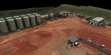
Our 3D models are perfect for inspecting well sites, gas plants, and other industrial facilities. We give you the ability to see, measure, and annotate every inch of your site from a computer screen in 3D.
Volumetric Measurements
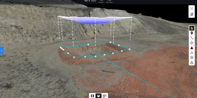
Have a hole you need to fill? We can measure the exact volume with our mapping software. This is included with any 3D model.
2D Models
Terrain Maps
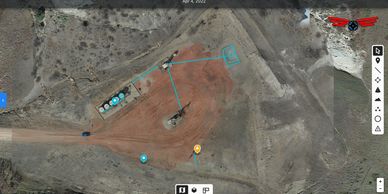
Our 2D models are a powerful tool to get a birds eye view of your operations. They also give you the ability to make accurate measurements of anything on site with the click of a mouse.
Terrain Maps
Annotations & Measurements
Terrain Maps
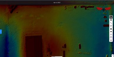
A useful feature of our 2D maps is the ability to see low points on your site. If you are having issues with sites holding water these maps will show you exactly how to fix it.
Annotations & Measurements
Annotations & Measurements
Annotations & Measurements

Each map we create is inspected in house, and any potential issues are relayed via annotation. Every annotation will have a measurement of the issue showing exactly how big the problem is.
Why us?
Annotations & Measurements
Annotations & Measurements

Our 20 years of oil and gas experience, paired with the best civilian drone on the market, gives you the best product for your operation.